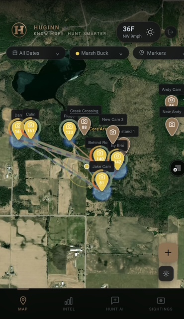
Map Your Property
Place cameras, stands, scrapes, and bedding areas directly on your satellite map. Every inch of your property, organized and searchable.
Huginn is in private beta. Drop your email and we'll reach out when your spot is ready.
No spam. We hate it as much as you do.
Drop pins, log trail cameras, and watch deer movement patterns emerge across your property. Huginn maps every sighting, tracks individual bucks across cameras, and shows you exactly where they're moving — and when.
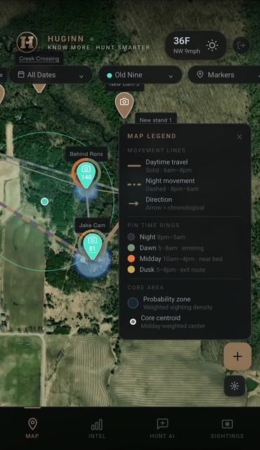
Buck Movement Tracking
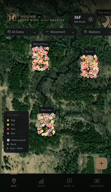
Seasonal Activity Dot Map
Time of Day Intelligence
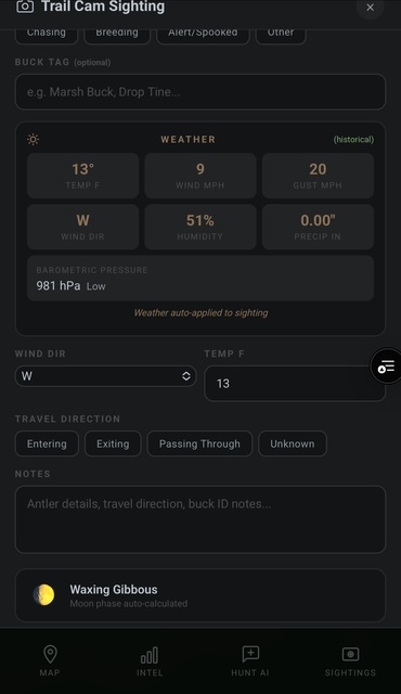
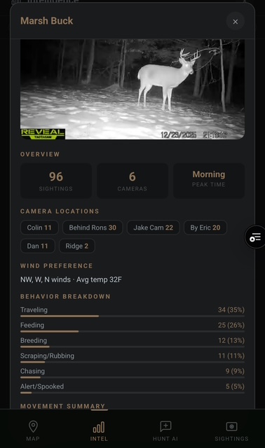
Upload a trail cam photo and Huginn's AI identifies the buck, matches it to your history, and auto-fills date, time, and weather. Every sighting builds a deeper profile — behavior, patterns, preferred conditions.
AI Buck Identification
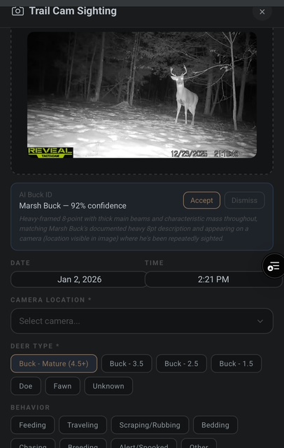
Auto-Applied Weather Data
Buck Profile Dossier
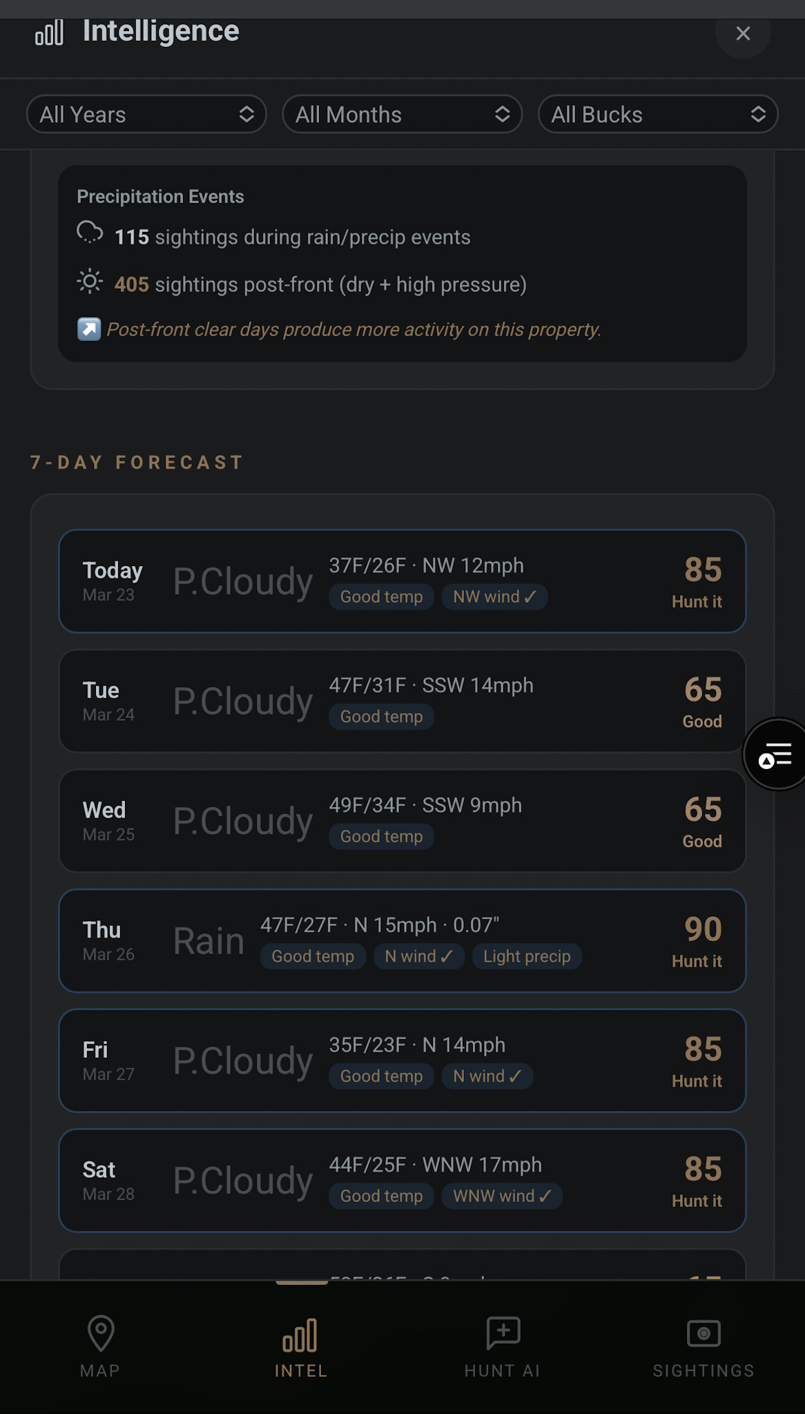
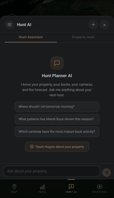
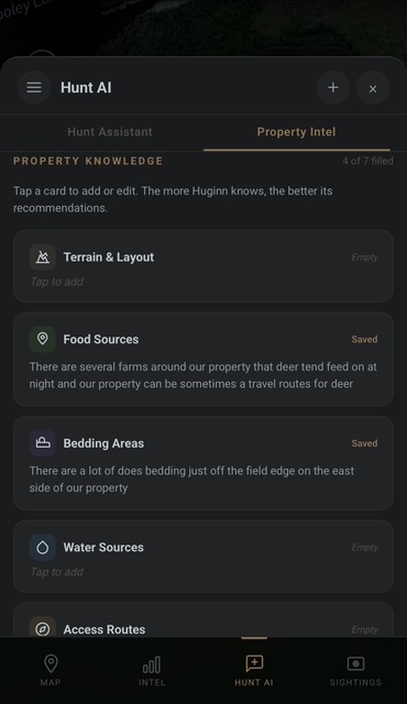
Huginn analyzes years of sighting data to tell you when to hunt, where to sit, and which bucks are moving. Daily hunt scores, AI-powered insights, and a property intelligence assistant that knows your land.
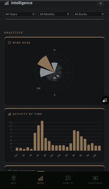
Wind Rose & Activity Analytics
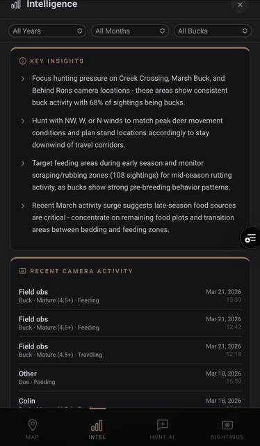
AI-Powered Key Insights
7-Day Hunt Forecast Scoring
Hunt AI Assistant
Property Intelligence Builder
Know More. Hunt Smarter.
The intelligence platform built for serious whitetail hunters
Place cameras, stands, scrapes, and bedding areas directly on your satellite map. Every inch of your property, organized and searchable.
Trail cam photos, field observations, and buck sightings — all in one place. AI identifies your named bucks automatically.
Huginn analyzes your data and tells you when, where, and how to hunt. Movement patterns, wind correlations, peak activity windows.
Huginn started as a personal project to solve a real problem — too much data scattered across trail cameras, notebooks, and memory. We built the tool we wished existed. Every feature is born from time in the field.
Every piece of intel. Building toward one moment.
Join the waitlist and we'll reach out when your spot is ready.
No spam. We hate it as much as you do.